|
Real-time Meteorological Observations
| |
|
|
From January 1997 to October 2000, a physical-biogeochemical
mooring was deployed to obtain continuous measurements of various atmospheric
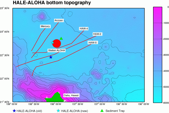
and oceanographic parameters. The mooring was located at 22° 28'N,
158° 8' W and was designated as Station HALE-ALOHA.
In August 2004, HALE-ALOHA was redeployed at a site 6 nautical miles west of
Station ALOHA (22° 46'N, 158° 5.5'W ) as part of the Multi-diciplinary
Ocean Sensors for Environmental Analyses and Networks (MOSEAN) project. MOSEAN
is directed toward new technologies that will lead to increased observations
that are essential for solving a variety of interdiciplinary oceanographic
problems. These include: biogeochemical cycling, climate change effects,
ocean pollution, harmful algal blooms (HABs), ocean ecology and underwater
visibility. This site is a collaboration with the University of
California Santa Barbara and WET
Labs.

|


