|
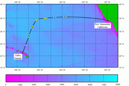
The objective of this cruise was to locate and sample the
microbial communities and biogeochemical properties associated with the
Pacific plastic patch between Honolulu, Hawaii and Port Hueneme, California.
Hydrographic and biogeochemical data was collected to characterize the
upper water column. A Manta trawl was used to map the horizontal
distribution of the plastic patch. A LISST and HYPERPRO radiometer were
used to characterize particle size distribution and optical properties
of the upper water column. Weather forecasts, shipboard ADCP data and
satellite images were used to help us locate the plastic patch which in
the past had been located in regions of calm weather between 30-35o N
Latitude and 150-130o W Longitude.
|


